| Previous Siege of Vicksburg Map | Siege of Vicksburg Index Page | 16th OVI Home Page | Next Siege of Vicksburg Map |
Map #2 - Siege of Vicksburg, Mississippi
May 23 to July 4, 1863
May 23 to July 4, 1863
Web Author's Notes:
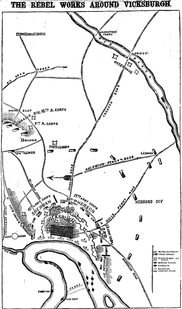
This simple map from the New York Times, published July 8, 1863, just after the surrender of Vicksburg, shows troop positions around Vicksburg but also shows Gen. Osterhaus' Ninth Division, including the 16th Ohio, performing rear guard duty about 10 miles east (map left is north) near the Big Black River Bridge.
This simple map from the New York Times, published July 8, 1863, just after the surrender of Vicksburg, shows troop positions around Vicksburg but also shows Gen. Osterhaus' Ninth Division, including the 16th Ohio, performing rear guard duty about 10 miles east (map left is north) near the Big Black River Bridge.
| Previous Siege of Vicksburg Map | Siege of Vicksburg Index Page | 16th OVI Home Page | Next Siege of Vicksburg Map |