| Previous Date | Day By Day Index | 16th OVI Home Page | Next Date |
Where was the regiment from
February 13 to 26, 1862
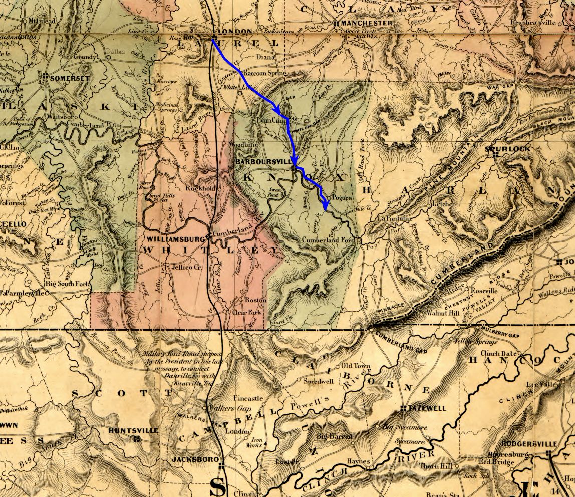
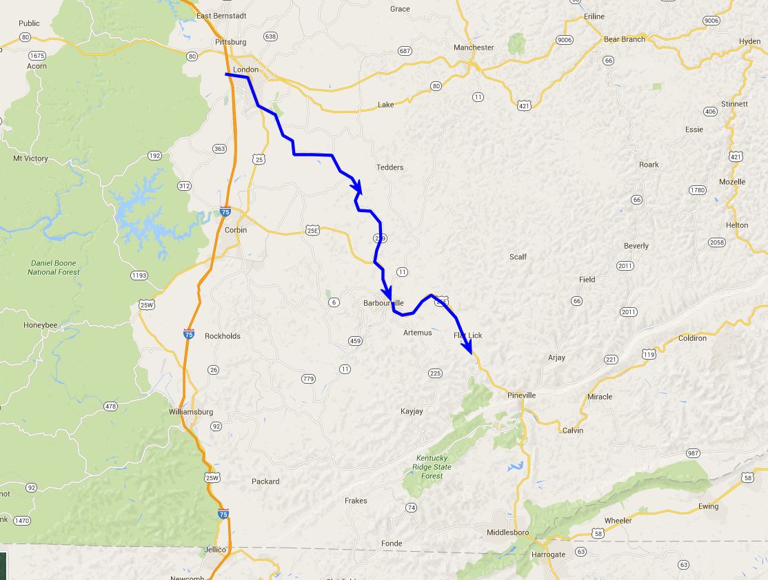
During this 14 day period the regiment camped on a knoll, just above the Cumberland River and south of Flat Lick, Kentucky. They were joined by the other regiments which formed their brigade. Cpl. Theodore Wolbach describes the camp:
...after arriving at the Cumberland River, we moved up and established our camp within four miles of Cumberland Ford. The spot selected was a hump or promontory in the river valley. Some of the old inhabitants recollected when during the rainy seasons the river was so excessively high as to form an island of this place, which was known to us while here as Camp Cumberland.
Wolbach mentions the stories of previous flooding because that's just what happened to the Union troops camping on the knoll above the Cumberland River as he goes on to tell us:
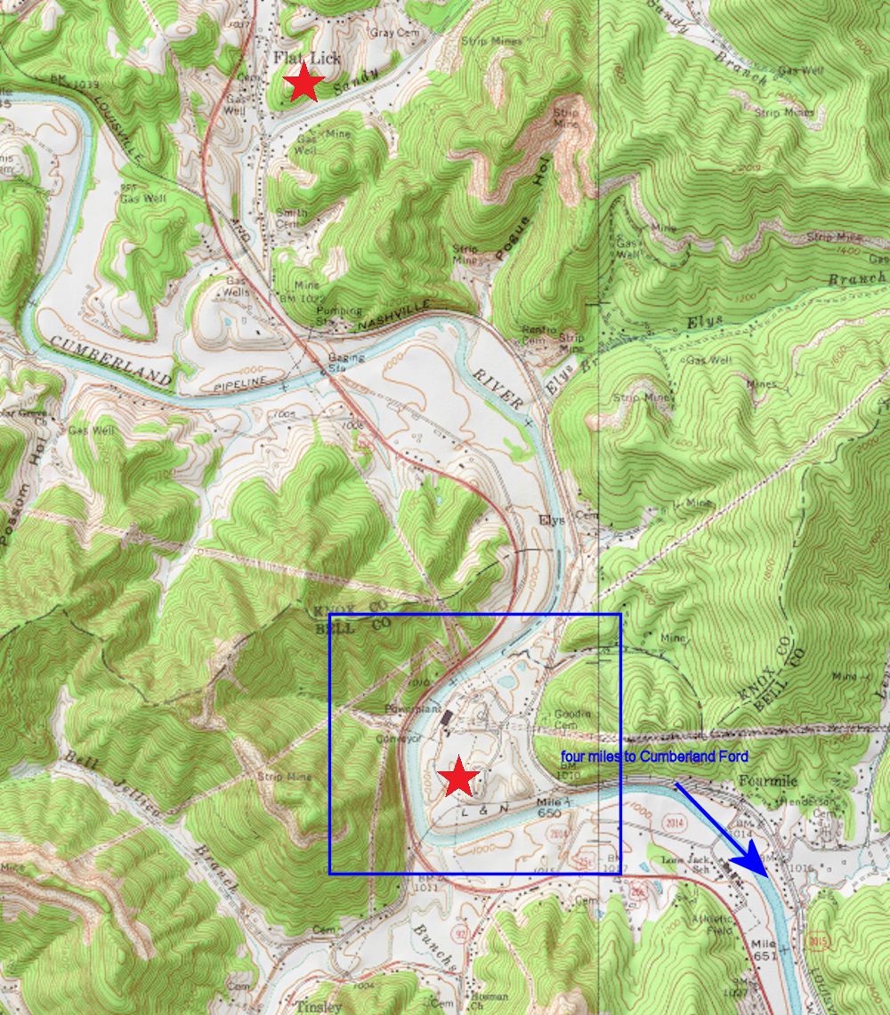
Several days after our arrival at Camp Cumberland it commenced to rain and rained incessantly for almost three days. The river rose to and beyond a point that it had not reached for many years. The camp became an island [February 23] and continued so for more than twenty-four hours, then the water receded as rapidly as it rose. ...The roads being submerged during the freshet our supply trains could not come up, and as a matter of course our rations were cut short, but as soon as it was possible men were sent to Flat Lick, six miles distant, to bring supplies on their backs.
While at this camp, on February 25, the soldiers received their first government pay, some three months after leaving Camp Tiffin, Ohio.
The exact location of Camp Cumberland has not been determined but is believed to have been on the north bank of the Cumberland River and from 3 1/2 to 4 miles up river from Cumberland Ford (now Pineville, Kentucky), just below a place called Pogue's
, to which there may be some related reference on modern maps as Pogue's Hollow
. The topographical map, below, shows some potential sites of the camp. The various references to mileages to and from this spot are inconsistent and add to the confusion on just where the camp was located.
| Previous Date | Day By Day Index | 16th OVI Home Page | Next Date |