| Previous Red River Campaign Image | Red River Campaign Index Page | 16th OVI Home Page | Next Red River Campaign Image |
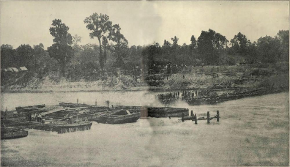
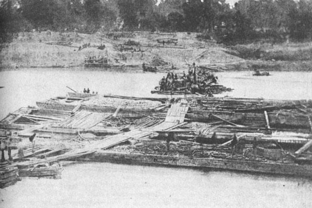
These are two photographs of the actual construction of Col. Bailey's lower dam. Note the "cribs" on the left (top photo) or in foreground (bottom photo), which were containers built to hold rocks, logs and other heavy materials, until they sank and blocked the left portion of the river. On the right (or far shore) can be seen the "tree dam", built out from the east bank, with heavy timber taken from the nearby woods (the new clearing visible), sunk in the river in an intricate weave and sealed with mud and rocks, to form the right half of the dam. The 150' open portion between the two dams would be sealed with barges filled with similar heavy materials.
Troops can be seen out on the dam and on the far shore. It is very possible, if not likely, some of these soldiers are part of the 16th Ohio, as the regiment was the first to be assigned and report to the east bank for work in building the dam.
It is estimated that this photo would have been taken sometime between May 2 and May 7, 1864.
The purpose of the dam was to raise the water level of the river, about 10 miles upstream, to allow the Federal gunboat fleet under Adm. David Porter to cross over the "upper falls" (rapids) and move down to Alexandria, just above the dam. Once the fleet made it past the upper rapids and formed near the dam, a small portion of the dam would be broken by a gunboat and the boats could then cross in the high water passing through the break and move past the "lower falls" and into deeper water below.
After some difficulty with the main dam holding during construction, Bailey decided to build some additional wing dams
near the upper rapids. This would take some of the pressure off the main dam and assist in the water level at the upper rapids. The plan ultimately worked and saved the entire gunboat fleet from having to be destroyed to keep it from falling into enemy hands.
Also, see a map of the Red River with Bailey's dams.
Taken from the west shore looking almost due east, directly across the dam project. Note large trees still being cut and dragged to the shore for placement in the dam.
| Previous Red River Campaign Image | Red River Campaign Index Page | 16th OVI Home Page | Next Red River Campaign Image |