| Previous Red River Campaign Map | Red River Campaign Index Page | 16th OVI Home Page | Next Red River Campaign Map |
Map #2 - The Red River Campaign
March 10 to May 22, 1864
March 10 to May 22, 1864
Web Author's Notes:
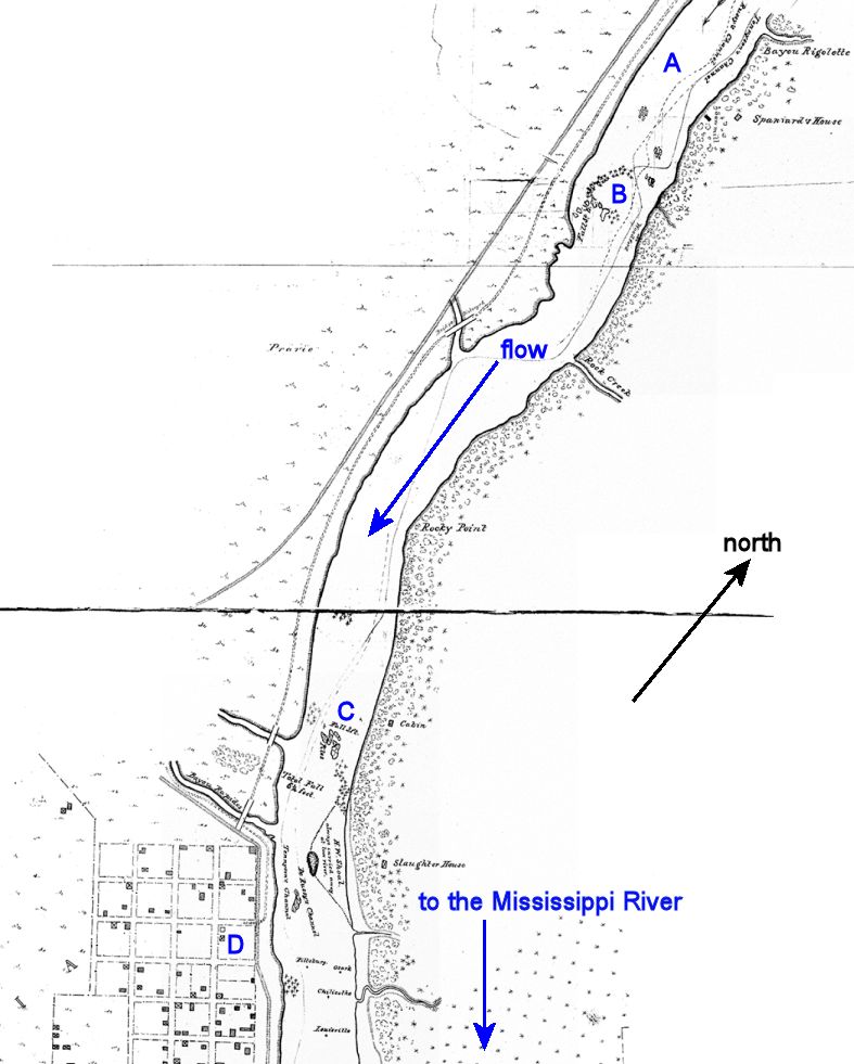
This is a map showing the area of the Red River where:
A - the Federal gunboats of Adm. David Porter were stranded above the "upper falls" or rapids due to low water levels
B - the upper falls
C - the lower falls, just above Alexandria; the Federal gunboats could not cross these rapids, also due to low water levels
D - Alexandria, Louisiana, currently occupied by the troops of Union General Nathaniel Banks, including the 16th Ohio Volunteer Infantry
| Previous Red River Campaign Map | Red River Campaign Index Page | 16th OVI Home Page | Next Red River Campaign Map |